
Most people picture the Australian Outback as a flat, featureless desert stretching endlessly in every direction. That picture is incomplete. What are Australian outback landscapes, really? They are a vast mosaic of geological formations, ancient river systems, salt lakes, woodlands, and living cultural records spanning millions of years. The Outback covers most of Australia's interior, from arid red deserts to semi-arid grasslands, and rewards anyone who looks closely with scenery that shifts dramatically with the season, the hour, and the angle of the sun.
Table of Contents
- Key Takeaways
- What are Australian outback landscapes, geographically speaking
- Iconic rock formations and what makes them extraordinary
- Vegetation zones and why they matter to photographers and travelers
- How fire, flood, and time shape what you see
- Practical photography and travel planning in the Outback
- My perspective on what the Outback actually teaches you
- Explore the Outback with Mark Gray's photography expertise
- FAQ
Key Takeaways
| Point | Details |
|---|---|
| Outback is a mosaic, not one desert | The Outback contains deserts, salt lakes, woodlands, gorges, and floodplains across a single vast region. |
| Iconic formations have cultural depth | Uluru and Kata Tjuta are not just photo subjects. They carry deep Indigenous cultural and geological meaning. |
| Vegetation defines the visual character | Mulga woodlands, spinifex grasslands, and saltbush create the textures and color palettes that define Outback scenery. |
| Natural processes keep landscapes dynamic | Fire, flash floods, and erosion continuously reshape what you see, making every visit genuinely different. |
| Lighting geometry is everything in photography | The angle and quality of light at different times of day transforms rock color, shadow depth, and detail. |
What are Australian outback landscapes, geographically speaking
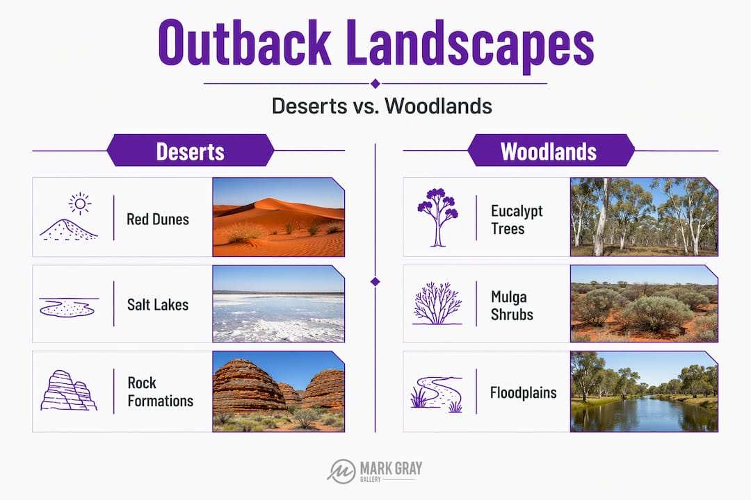
The Outback does not have a fixed, government-defined border. It is broadly understood as the arid and semi-arid interior of Australia, and its scale is staggering. You can fly roughly 2,000 miles between Sydney and Darwin without seeing significant human habitation. From space, it reads as a vast reddish expanse. On the ground, it is far more complex.
Rather than a single desert system, the Outback is a mosaic of landscape types with dramatically different vegetation, topography, and water patterns. Understanding this variety is the foundation for both thoughtful travel and informed photography.
| Landscape type | Key features | Notable examples |
|---|---|---|
| Arid sandy deserts | Red sand dunes, sparse spinifex | Simpson Desert, Great Victoria Desert |
| Semi-arid plains | Low shrublands, clay soils | Nullarbor Plain, Mitchell Grass Downs |
| Mulga woodlands | Acacia-dominated dryland scrub | Mulga Lands, Southwest Queensland |
| Salt lakes | Seasonal brine flats, reflective surfaces | Lake Eyre (Kati Thanda), Lake Torrens |
| Gorges and ranges | Eroded sandstone, layered rock walls | MacDonnell Ranges, Flinders Ranges |
| Ephemeral river country | Flood-carved channels, gidgee woodlands | Cooper Creek, Diamantina River system |
Each of these types produces a fundamentally different visual experience and demands a different approach from both the traveler and the photographer. The Nullarbor Plain stretches so flat and treeless that it feels like the edge of the earth. The MacDonnell Ranges fracture the horizon with ancient ridgelines in deep ochre and purple. Lake Eyre, when it floods, becomes one of the most visually surreal places on the planet.
Pro Tip: When planning an Outback trip, select two or three distinct landscape types rather than targeting a single region. The contrast between a salt lake and a sandstone gorge creates a far richer photographic and experiential story.
Iconic rock formations and what makes them extraordinary
No discussion of the features of Australian landscapes is complete without Uluru and Kata Tjuta. These formations sit within Uluru-Kata Tjuta National Park in the Northern Territory and are among the most recognizable natural wonders of Australia.
Uluru is a single sandstone inselberg that rises 348 meters above the surrounding plain. What makes it visually arresting is its color behavior. The rock shifts from deep ochre to fiery orange to violet and near-purple depending on the time of day and cloud cover. Kata Tjuta, known as the Olgas, is a separate group of 36 domed formations, with Mount Olga reaching 1,066 meters above sea level. The domes are composed of conglomerate rock, which gives them a rougher, more textured appearance than Uluru's smooth sandstone face.
Both formations carry profound cultural significance for the Anangu people, the Traditional Owners of the land. Their stories, knowledge, and laws are embedded in every feature of these rocks. Visiting with that awareness changes how you see them entirely.
From a photography standpoint, these sites offer some of the most compelling types of Australian outback photography subjects available anywhere:
- Pre-dawn positioning: The best color saturation at Uluru happens in the 20 minutes after sunrise when direct light hits the eastern face. Arrive at least 45 minutes before sunrise to secure position.
- Weather as an asset: Overcast skies soften harsh contrast and bring out rock texture that direct sun bleaches out.
- Kata Tjuta's Valley of the Winds: The interior walking track reveals intimate views of the domes that the car park lookout never shows.
- Avoid midday: Harsh overhead light flattens the geometry of both sites and washes out the warm tones that make them iconic.
Pro Tip: Lighting geometry matters more than gear at these sites. A basic camera at golden hour will outperform an expensive setup at noon every time.
Vegetation zones and why they matter to photographers and travelers
The plant communities across the Outback do more than fill the space between rocks. They define the texture, color, and mood of every landscape type.
The Mulga Lands cover a substantial portion of inland Australia, particularly across southwestern Queensland and into New South Wales. Mulga, or Acacia aneura, is a tough, drought-adapted tree that channels rainfall from its branches and leaves directly down its trunk to its roots, allowing it to survive on rainfall levels that would kill most trees. After significant rain, mulga woodlands transform quickly. Within weeks, the understory fills with wildflowers, the soil deepens in color, and the photographic possibilities multiply dramatically.
Here is how the major vegetation types shape different outback scenery:
- Spinifex grasslands: These spiky, hummock-forming grasses cover enormous areas of sandy desert. They create strong visual patterns and an almost graphic quality in aerial photography. At ground level, the textures are extraordinary.
- Saltbush plains: Atriplex species create silver-gray carpets across clay pans and flood-modified plains. The color contrast against red soil is striking and often underused as a photography subject.
- Acacia and eucalyptus woodlands: These form the transition zones between desert and more productive country. They support greater bird and reptile diversity and add vertical structure to landscapes that photographers often overlook.
- River red gums along dry watercourses: Ghost gum and river red gum trees following dry creek lines are among the most distinctive examples of stunning Australian outback scenery, especially in the MacDonnell Ranges.
Seasonal variation is dramatic. A landscape that appears desiccated and brown in October can be carpeted with everlasting daisies in September following good winter rain. This unpredictability is part of what makes exploring the Outback so rewarding for anyone with a camera and patience.
Pro Tip: Understanding dominant vegetation across a region before you travel helps you predict what color palettes and textures you will encounter. Mulga country photographs very differently from spinifex desert or river red gum creek lines.
How fire, flood, and time shape what you see
The Outback is not a static environment. It is a living archive, and fire, flood, and geologic time are its primary authors.
Flash floods in the Outback are sudden and transformative. Ephemeral rivers like Cooper Creek carry water only after major rainfall events, but when they flow, they carve channels, deposit sediment, and fill waterholes that sustain entire ecosystems for months. The gorges of the MacDonnell Ranges were carved by ancient rivers operating over hundreds of millions of years. Standing inside Ormiston Gorge, you are reading a physical record of forces that predate human existence.
Cultural burning, practiced by Aboriginal Australians for tens of thousands of years, is the other great shaping force. This practice, sometimes called firestick farming, deliberately burns sections of country in rotation to clear old growth, promote new plant growth, and manage habitat for animals. The result is a patchwork landscape of burned and unburned country that creates distinct visual patterns. From the air, these patterns are extraordinary. At ground level, a recently burned area beside regenerating spinifex shows the Outback's resilience in real time.
"The Outback is not barren. It is an ecologically vibrant patchwork shaped by cultural and natural forces working across deep time."
For photographers, this means that scorched earth patches and ephemeral water signs are not blemishes on the landscape. They are active stories worth capturing. A charred spinifex plain with bright green regrowth pushing through is one of the most honest images you can take of the Outback.
Practical photography and travel planning in the Outback
Knowing what are Australian outback landscapes in theory is one thing. Applying that knowledge to an actual trip is another. Approaching the Outback with a clear framework saves time and produces better results, both photographically and experientially.
- Categorize your target landscapes before you leave. Decide whether your priority is monolithic rock formations, desert dunes, gorge systems, or woodland corridors. Each has different peak seasons, access requirements, and lighting conditions.
- Plan shoots around sun angle, not just sunrise and sunset. At some gorges and canyon-like formations, the sun only illuminates the interior walls at specific times. At Standley Chasm in the MacDonnell Ranges, solar noon is the optimal time to photograph because direct overhead light floods the narrow gorge walls. This is the opposite of the usual golden-hour advice.
- Factor in seasonal rainfall patterns. Central Australia is best visited between April and September when temperatures are manageable. The Channel Country in western Queensland, however, is at its most dramatic after summer rains when the floodplains fill.
- Respect cultural protocols at sacred sites. Several locations within Outback national parks restrict photography, particularly of areas sacred to Traditional Owners. Research specific sites before you visit and follow signage strictly.
- Use weather as a creative tool. A passing storm over a desert plain, a rainbow above red dunes, or storm light on sandstone cliffs are among the most memorable landscape photography experiences available in Australia. Do not retreat indoors when conditions change.
Planning shoots by landform type rather than geography alone dramatically increases the variety and quality of images you bring home. The landscape photography techniques that work on coastal cliffs require significant adjustment for flat desert light and wide open terrain.
My perspective on what the Outback actually teaches you
I have photographed Outback landscapes across dozens of locations over many years, and the single biggest shift in my work came when I stopped looking for the classic postcard image and started reading the land itself.
The Outback appears empty to a visitor moving quickly. It reveals itself to anyone who slows down. I have stood in the middle of what looked like dead, featureless desert and watched a wedge-tailed eagle spiral a thermal directly above me, while a thorny devil moved through spinifex at my feet and the soil beneath me showed the faint channels of a flood system that last flowed three years ago. Over 6,000 plant species and hundreds of adapted reptile and bird species occupy this supposedly barren country. None of that shows up in a rushed drive-through.
The cultural dimension matters just as much. When Anangu guides interpret Uluru's features through their own knowledge system, the rock transforms. It stops being a photographic trophy and becomes a chapter in a story that is tens of thousands of years old. That shift in perception produces better photographs because you are photographing with understanding rather than just reaction.
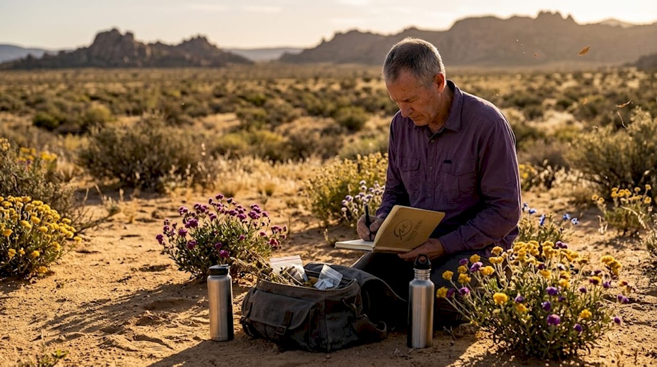
My honest advice: spend at least twice as long in each location as you think you need. The light changes, the weather changes, and so does your own vision. Some of my strongest Outback images came on a second morning in a location I had already written off the evening before.
— Mark
Explore the Outback with Mark Gray's photography expertise
The Australian Outback rewards those who approach it with knowledge, patience, and the right guidance. Mark Gray has spent decades photographing across Australia's extraordinary interior, capturing everything from the burning flanks of Uluru to the vast silver mirror of a flooded Lake Eyre. That experience is now available to photographers at every level.
At markgray.com.au, you will find a curated collection of limited edition Outback landscape prints alongside opportunities to join professionally led photography workshops and multi-day tours across Australia's most inspiring regions. Whether you want to learn how to read desert light, capture iconic rock formations with intent, or simply experience these landscapes alongside an expert, there is a workshop designed for you. Explore the regional photography workshops available and take the first step toward seeing the Outback the way it deserves to be seen.
FAQ
What defines the Australian Outback?
The Australian Outback is broadly defined as the arid and semi-arid interior of Australia, characterized by sparse population and vast open terrain. It includes deserts, salt lakes, woodlands, gorges, and river systems rather than a single uniform desert type.
What are the most photogenic types of outback scenery?
The most compelling types include sandstone monoliths like Uluru, desert dune fields, gorge systems in the MacDonnell and Flinders Ranges, flooded salt lakes, and mulga woodland corridors after rain.
When is the best time to visit Australian Outback landscapes?
April through September offers the most comfortable temperatures for central Australia, with May and June providing particularly stable light conditions. Wildflower displays in inland regions typically peak between August and October following good winter rain.
How does Uluru change color throughout the day?
Uluru's sandstone surface reflects different wavelengths of light depending on sun angle, shifting from deep orange at sunrise through warm ochre in morning light to near-purple at sunset under certain atmospheric conditions.
Do I need guided tours to photograph the Outback effectively?
While self-guided travel is possible, guided photography tours led by experienced photographers dramatically reduce the learning curve around light timing, access to lesser-known locations, and understanding of cultural protocols at sacred sites.