Landscape photography captures place identity by visually encoding the ecological, cultural, social, and experiential dimensions that define how a location is recognized, remembered, and felt. This goes far beyond scenic beauty. A photograph of the Australian outback's red earth, Iceland's volcanic coastline, or a French Polynesian lagoon at dawn is not simply a record of light and geography. It is an argument about what a place means. Understanding this distinction separates photographers who document scenery from those who communicate something irreplaceable about the world's most extraordinary locations.
How landscape photography captures place identity
Place identity, as a formal concept, originates in geography and environmental psychology. Edward Relph's foundational work argues that place identity is rooted in authentic, lived phenomenological experience rather than coordinates on a map. His text, reissued by SAGE in 2026, remains the starting point for any serious discussion of what makes a location feel irreplaceable. For photographers, this matters because the camera becomes a phenomenological tool: it shapes what viewers experience as real and authentic about a place they may never visit in person.
The recognized industry term for this practice is place-based visual storytelling, though "place identity in photography" has become the common shorthand across cultural geography and fine art circles. Both terms point to the same challenge: how do you translate the full weight of a location into a single frame?
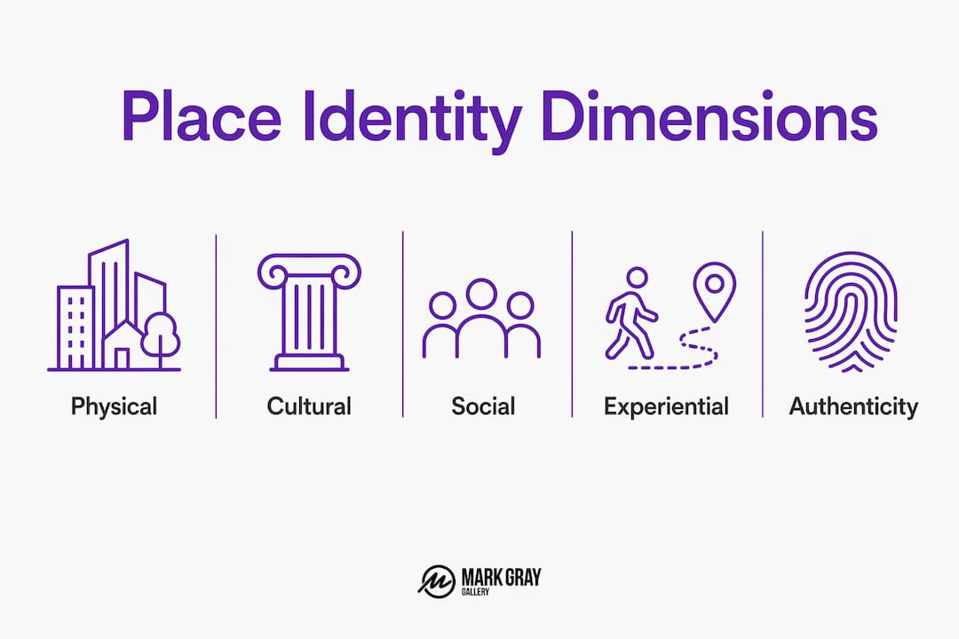
A multi-dimensional framework from a 2026 Satoyama Identity thesis identifies four interrelated channels through which place identity forms. Each one is directly relevant to how you approach a shoot:
- Physical-ecological dimension: The landforms, vegetation, water, and light that give a place its visual signature. Norway's fjords and Australia's red desert are immediately recognizable because their physical character is singular.
- Symbolic-cultural dimension: The stories, myths, ceremonies, and historical events that a community associates with a location. A photograph that ignores this layer captures geography but misses meaning.
- Social-community dimension: The human relationships and collective practices tied to a place. Markets, seasonal gatherings, and working landscapes all carry social identity that pure scenery photography overlooks.
- Personal-experiential dimension: The individual emotional and sensory memories that make a place feel like home or sacred ground to those who inhabit it.
Photographers who consciously address all four dimensions produce images that resonate at a depth that purely aesthetic work cannot reach. Recognizing which dimension is dominant in a given location is the first skill worth developing.
How do photographers capture place identity through composition and storytelling?
The most precise way to think about a photograph's relationship to place is as a storytelling contract. Every compositional choice you make tells viewers what to pay attention to, what to feel, and what to believe about a location. Photographers working with cultural and place identity build images through storytelling contracts, using guides, oral histories, and archival context to embed knowledge that viewers interpret beyond the visible frame.
Gayatri Ganju's forest photography, featured in Aperture's 2026 editorial, is one of the most instructive contemporary examples. Ganju spent extended time with the Indigenous Kurumba people before photographing their sacred forests in southern India. The resulting images carry ecological and cultural memory that no amount of technical skill alone could produce. Her practice demonstrates that participatory photographic approaches produce more ethically grounded and culturally embedded expressions of place identity than extractionist visual strategies ever can.
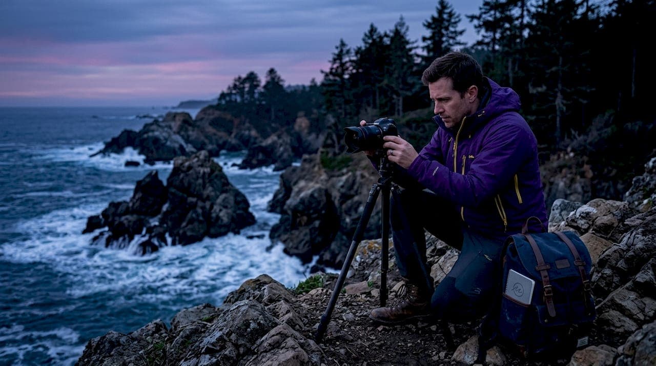
Here is a practical sequence for photographers who want to move from scenic capture to genuine place identity work:
- Research the location's cultural and ecological history before you arrive. Read local histories, speak with community members, and study archival photographs. What has changed? What has been lost? What is fiercely protected?
- Identify the dominant identity dimension at your specific site. A working harbor carries social-community identity. An ancient forest carries symbolic-cultural and physical-ecological identity simultaneously.
- Compose to include identity cues, not just visual anchors. A worn path, a weathered fence post, or a specific species of tree can carry more place meaning than a dramatic sky.
- Engage local guides or community members wherever possible. Their knowledge will reveal details that no amount of pre-trip research can replicate.
- Revisit the same location across seasons and conditions. Place identity is not static. How seasons change the visual and emotional character of a location is one of the most powerful storytelling tools available to landscape photographers.
Pro Tip: Before you press the shutter, ask yourself which of the four identity dimensions is most visible in your frame. If the answer is only the physical-ecological one, consider what compositional adjustment could introduce a cultural or social layer.
How does landscape photography shape collective and cultural identity?
Photography does not just record place identity. It actively constructs it. David Matless, in Landscape and Englishness (2026 edition), argues that landscape debates include photography as a material force shaping national identity. The images that circulate most widely about a country become the country's self-image. This is why the photographs that define Australia internationally tend to emphasize the outback and the coast, even though most Australians live in dense urban environments.
This constructive power carries political weight. A 2026 Island Studies Journal article on contemporary photography from Cyprus frames the medium as a site for postcolonial narrative creation, where photographers actively counter colonial visual legacies by reframing what their landscapes mean and to whom. For contested or heritage locations, the most responsible photographers move from capturing loss to representing networks and relations over time.
Researchers have now developed a measurable construct called Place Identity Intensity (PII) to track how landscape imagery contributes to collective recognition. A 2026 Springer Nature study applied geographically weighted regression to urban regeneration sites, linking built environment factors to PII scores derived from social media location tags. This means that the photographs people share from a location are now a quantifiable signal of how strongly that place registers in collective consciousness.
| Dimension | How photography engages it | Example |
|---|---|---|
| Physical-ecological | Captures landforms, light, and species that define visual character | Red earth of the Australian interior |
| Symbolic-cultural | Embeds historical and ceremonial meaning through context and framing | Sacred forest imagery by Gayatri Ganju |
| Social-community | Documents human practices and collective use of place | Working harbors, seasonal markets |
| Personal-experiential | Evokes emotional memory through sensory detail and intimacy | Close-up textures, familiar light conditions |
"The landscape is never just scenery. It is a record of human decisions, ecological processes, and cultural memory compressed into a single visible surface." — David Matless, Landscape and Englishness
Place attachment also has measurable behavioral consequences. A 2026 Frontiers in Psychology study found that place attachment predicts pro-environmental intentions, meaning that landscape photography which deepens emotional connection to a location can directly influence conservation behavior. This gives photographers working in threatened ecosystems a responsibility that extends well beyond aesthetics.
What practical approaches help photographers authentically capture place identity?
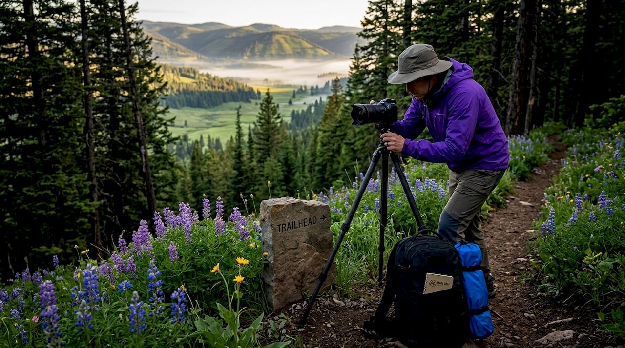
The most common mistake photographers make when approaching place identity work is operating at the wrong spatial scale. Place identity varies significantly depending on whether you are working at the scale of a national park, a village, or a single field. Focusing only on broad scenic views can overlook the local-level identity experiences that residents inhabit daily. A sweeping panorama of the Norwegian coast is spectacular, but the identity of a specific fishing community lives in the texture of its nets, its boats, and its harbor walls.
Practical approaches that consistently produce stronger place identity work include the following:
- Conduct site research across multiple sources. Combine satellite imagery, local historical archives, ecological surveys, and conversations with long-term residents. Each source reveals a different identity layer.
- Photograph at the scale where identity is most concentrated. Sometimes that is a wide vista. More often, it is a mid-range or intimate frame that captures a specific cultural or ecological detail.
- Integrate narratives of change. Biodiversity loss, land use shifts, and climate effects are part of a place's current identity. Citizen-collected digital photography has demonstrated this powerfully: a 2026 BBC-featured Scottish collection showed how citizen photography exposes conservation challenges that professional photographers had not prioritized.
- Practice ethical collaboration. When photographing Indigenous or culturally sensitive landscapes, seek permission, share images with communities before publication, and credit local knowledge explicitly.
- Use weather and light as identity signals, not just mood tools. The specific quality of light in a place at a specific time of year is part of its identity. How weather shapes the atmosphere of a location is inseparable from how that location feels to the people who live there.
Pro Tip: Build a pre-shoot identity brief for each location. List the dominant physical, cultural, social, and experiential characteristics you want to represent. Treat it the way a documentary filmmaker treats a shot list: as a creative commitment, not a rigid script.
The types of landscape photography techniques you deploy should follow from your identity brief, not precede it. Technique serves meaning. Meaning does not serve technique.
Key takeaways
Landscape photography captures place identity most powerfully when it addresses all four dimensions of place simultaneously: physical-ecological, symbolic-cultural, social-community, and personal-experiential.
| Point | Details |
|---|---|
| Place identity is multi-dimensional | Physical, cultural, social, and experiential layers all require deliberate attention in your framing. |
| Photography constructs identity, not just records it | Images that circulate widely become the dominant self-image of a place, carrying real cultural and political weight. |
| Participatory methods produce deeper work | Collaborating with local communities and guides embeds cultural knowledge that transforms scenic images into identity statements. |
| Spatial scale matters | Broad vistas capture regional identity; intimate frames capture the daily lived identity that residents actually experience. |
| Place attachment drives conservation behavior | Landscape photography that deepens emotional connection to a location measurably increases pro-environmental intentions. |
Why I believe place identity is the most undervalued concept in landscape photography
Most photographers I encounter are technically accomplished. They understand light, composition, and post-processing at a high level. What many have not yet developed is a framework for why a particular place deserves to be photographed at all, beyond the fact that it looks extraordinary.
I have spent years photographing locations across Australia, Iceland, Norway, French Polynesia, and beyond. The images I am most proud of are not necessarily the most technically perfect ones. They are the ones where I took the time to understand what made a specific place irreplaceable before I raised the camera. The red earth of the Australian interior, for example, is not just a color. It is a geological and cultural record that spans tens of thousands of years. Photographing it without that awareness produces a postcard. Photographing it with that awareness produces something that can change how a viewer relates to the continent.
The participatory approaches described in Gayatri Ganju's work are not just ethically preferable. They are photographically superior. When you listen deeply to a place and its people, you see details that no amount of technical preparation reveals. That is the discipline I encourage in every workshop I run: arrive curious, not just equipped.
The emerging role of citizen photography and social media in measuring Place Identity Intensity is genuinely exciting. It means that the images photographers share are now part of a measurable cultural record. That is both an opportunity and a responsibility worth taking seriously.
— Mark
Explore award-winning landscape photography rooted in place identity
Mark Gray's work across Australia, Iceland, Norway, New Zealand, and French Polynesia represents some of the most celebrated place identity photography available today. Each limited edition print in the Mark Gray Gallery collection reflects years of site research, cultural engagement, and technical mastery working together. If you want to deepen your own understanding of how to capture landscapes with this level of authenticity, Mark's one-day photography courses and multi-day workshop tours across Australia and worldwide offer direct, hands-on experience. Explore the full collection of prints, workshops, and licensing options at markgray.com.au.
FAQ
What is place identity in photography?
Place identity in photography refers to the way images communicate the physical, cultural, social, and experiential dimensions that make a location distinct and meaningful. Edward Relph's foundational place theory defines this as rooted in authentic, lived experience rather than geography alone.
How do landscape photos convey cultural identity?
Landscape photos convey cultural identity by embedding symbolic, historical, and community-specific cues within the frame, going beyond scenic documentation. David Matless argues that widely circulated landscape imagery actively shapes national and group self-image, making photographic choices inherently political.
Why does spatial scale matter when capturing place identity?
Broad scenic views capture regional or national identity, while intimate frames reveal the daily lived identity that local residents actually experience. Focusing exclusively on panoramic vistas can miss the community-level details that carry the strongest place attachment for the people who inhabit a location.
What is Place Identity Intensity (PII)?
Place Identity Intensity is a measurable construct of collective place identity operationalized through social media location tags and geographically weighted analysis. A 2026 Springer Nature study linked built environment factors to PII scores, showing that landscape imagery directly contributes to how strongly a place registers in collective consciousness.
How can photographers approach place identity ethically?
Ethical place identity photography requires collaboration with local communities, seeking permission before photographing culturally sensitive landscapes, and crediting local knowledge explicitly. Participatory approaches, as demonstrated by Gayatri Ganju's work with the Kurumba people, produce more culturally embedded and authentic results than extractionist visual strategies.